How will Mars Science Laboratory navigate to Mars? Very precisely
Getting the Mars Science Laboratory to the Red Planet isn’t as easy as just strapping the rover on an Atlas V rocket and blasting it in the general direction of Mars. Spacecraft navigation is a very precise and constant science, and in simplest terms, it entails determining where the spacecraft is at all times and keeping it on course to the desired destination.
And, says MSL navigation team chief Tomas Martin-Mur, the only way to accurately get the Curiosity rover to Mars is for the spacecraft to constantly be looking in the rearview mirror at Earth.
“What we do is ‘drive’ the spacecraft using data from the Deep Space Network,” Martin–Mur told Universe Today. “If you think about it, we never see Mars. We don’t have an optical navigation camera or any other instruments to be able to see or sense Mars. We are heading to Mars, all the while looking back to Earth, and with measurements from the Earth we are able to get to Mars with a very high accuracy.”
This high accuracy is very important because MSL is using a new entry, descent and landing guidance system which will allow the spacecraft to land more precisely than any previous landers or rovers.
“It is very challenging, and even though it is something similar to what we have done before with the Mars Exploration Rover (MER) mission, this time it will be done at an even higher level of precision,” Martin-Mur said. “That allows us to get to a very exciting place, Gale Crater.”
On Earth, we constantly can find exactly where we are with GPS – which is on our cell phones and navigation equipment. But there is no GPS at Mars, so the only way the rover will be able to head to –and through — a precise point in the Red Planet’s atmosphere is for the navigation team to know exactly where it the spacecraft is and for them to keep telling the spacecraft exactly where it is. They use the Deep Space Network (DSN) for those determinations from launch, all the way to Mars.
The Deep Space Network consists of a network of extremely sensitive deep space communications antennas at three locations: Goldstone, California; Madrid, Spain; and Canberra, Australia. The strategic placement approximately 120 degrees apart on Earth’s surface allows constant observation of spacecraft as the Earth rotates.
But of course, it’s not as easy as just getting the rocket from Point A to Point B since Earth and Mars are not fixed positions in space. Navigators must meet the challenges of calculating the exact speeds and orientations of a rotating Earth, a rotating Mars, as well as a moving, spinning spacecraft, while all are simultaneously traveling in their own orbits around the Sun.
There are other factors like solar radiation pressure and thruster firings that all have to be precisely calculated.
Martin-Mur said even though MSL is a much bigger rover with a bigger spacecraft and backshell than the MER mission, the navigation tools and calculations aren’t much different. And in some ways, navigating MSL might be easier.
“The Atlas V vehicle provides a much more precise launching and can put us in a more precise path than the MER, which used a Delta II,’ Martin-Mur said. “This allows us to use less propellant, proportionally per pound, to get to Mars than the MER rovers did.”
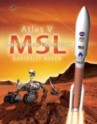
 is scheduled to launch as part of the Mars Science Laboratory mission. Credit: NASA")
The MER rovers and spacecraft weighed about 1 ton, while MSL weighs almost 4 tons. MSL is allotted 70 kg of propellant for the cruise stage, while the MER rovers each used about 42 kg of propellant.
Interestingly, for the MSL spacecraft to descend through Mars’ atmosphere and land, the spacecraft will use about 400 kg of propellant.
Additionally, Martin-Mur said more precise planetary ephemeris and Very Long Baseline Interferometry measurements are available, enabling the navigation to be able to deliver the spacecraft to the right place in the atmospheric entry interface, so the vehicle finds itself in the range of parameters that it has been designed to operate.
Navigation at Launch
It all starts with years of preparations and calculations by the navigation team, which must calculate all the possible trajectories to Mars depending on exactly when the Atlas V rocket launches with MSL aboard.
In some cases there are literally thousands of launch opportunities and all the possible trajectories must be calculated precisely. The Juno mission, for example, had two-hour daily launch windows with 3,300 possible launch opportunities. For MSL the daily launch windows contain liftoff opportunities in 5 minutes increments. Across the 24 day launch period the team has calculated 489 different trajectories for all the possible launch opportunities.
But ultimately, they will end up using only one.
“This is not something you do on the fly – you prepare all this well in advance so you have time to sit back and assess it and check it,” said another member of the MSL navigation team, Neil Mottinger, who has worked at the Jet Propulsion Laboratory since 1967. He’s worked on navigation for many missions like Mariner, Voyager, the MER, and several international missions.
“The initial function of navigation at launch is to determine the actual spacecraft trajectory well enough so the spacecraft signal will be well within the beam-width of the DSN antennae,” Mottinger told Universe Today.
The Mars Science Laboratory will separate from the rocket that boosted it toward Mars at about 44 minutes after launch, with the navigator’s tracking the spacecraft’s every move.
Mottinger added that without the DSN’s communication capabilities, there are no planetary missions. “The Navigation team does whatever it can to make sure there aren’t any gaps in communication,” he said. “It’s crunch time during the first 6-8 hours after launch to be able to determine the exact position of the spacecraft.”
From the recent problems with the Phobos-Grunt mission, it is evident how difficult it is to track and communicate with a just-launched spacecraft.
Mid-course Corrections
Again, the navigation team has modeled and calculated all the maneuvers and thruster burns for the mission. Once MSL is on its way to Mars, the navigation team will revisit all their models and design the maneuvers to take the spacecraft to the right entry interface at Mars.

“We’ll keep doing orbit determination and re-designing the maneuvers for the spacecraft,” said Martin-Mur. “MSL has 1 lb thrusters – the same size as the MER spacecraft — but our spacecraft is almost four times heavier so the maneuvers we do take a long time – some will take hours.”
For interplanetary navigation, the engineers use distant quasars as landmarks in space for reference of where the spacecraft is. Qusars are incredibly bright, but are at such colossal distances that they don’t move in the sky like nearer background stars do. Martin-Mur provided a list of nearly 100 different quasars that could be used for this purpose, depending on where the spacecraft is.
“It is interesting,” Martin-Mur mused, “with quasars we are using something that is billions of light years away from us, from the very early universe, which are so old that they might not even be there anymore. It is really cool that we are using an object that currently may not exist anymore, but using them for very precise navigation.”
The navigation team also needs to model the solar radiation pressure – the affect the Sun’s radiation has on the spacecraft.
“We know very well, thanks to our friends from the Solar Systems Dynamics group, where Mars is going to be and where the Earth and Sun are,” said Martin-Mur. “But since this spacecraft has not been in space before, what is not known precisely is how solar radiation pressure will affect the surface properties of the spacecraft, and how it will perturb the spacecraft. If we don’t have a good model for that, we could be hundreds of kilometers off as the spacecraft goes from Earth to Mars.”
Arriving at Mars
As the spacecraft approaches Mars, it is very important to know precisely where the spacecraft is. “We need to target the spacecraft to the right entry point,” said Martin-Mur, “and tell the spacecraft where it will enter, so it will be able to find its way to the landing site.”
The MSL Entry Descent and Landing Instrumentation, or MEDLI, will stream information back to Earth as the probe enters the atmosphere, letting the navigators — and the science team – know precisely where the rover has landed.
Only then will the navigation team be able — maybe — to breathe a sigh of relief.
Source: Universe Today


