Australia's Barrier Reef to get Google treatment

Australian scientists mapping the Great Barrier Reef will broadcast their findings in partnership with Google, emulating its "Street View" to spotlight the impact of climate change.
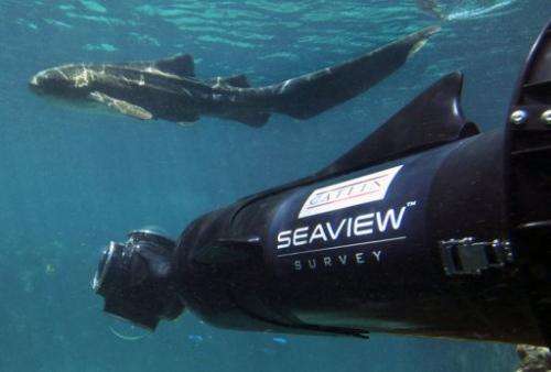
The University of Queensland's Seaview Survey will use custom-designed cameras and diving robots to plumb never-before-seen depths of the reef off Australia's northeast coast.
It is a scientific expedition with an everyman twist, according to chief scientist for the project, Ove Hoegh-Guldberg.
A special four-lensed camera, which can be held by a scuba diver swimming through and over the corals, will capture a "rapid visual census" of life forms at 20 sites along the entire 2,300-kilometre (1,400-mile) length of the reef.
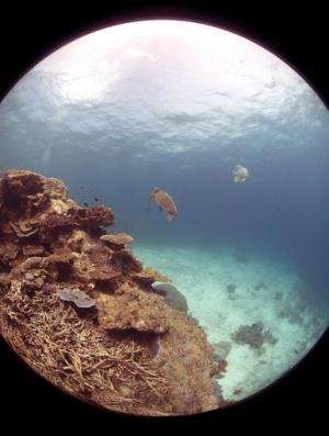
An estimated 50,000 panoramas, shot in 360-degree high-definition, will then be uploaded to Google's Panoramio site for use on Google Maps and Google Earth.
The result will be a kind of undersea version of its "Street View" function, which allows web users to access street scenes around the world.

"By using some really nifty digital technology to create 360-degree imagery we're essentially able to allow people to slip into the Great Barrier Reef and go for a dive as if they were coming with us," Hoegh-Guldberg told AFP.
The expedition, which will officially depart in September, will also have a dedicated YouTube channel documenting its progress in real-time.
Hoegh-Guldberg said its primary focus would be recording the reef for later comparisons to measure the effects of climate change, as well as mapping depths unreachable by scuba divers, about which very little is known.
In particular, he said the project team was interested in how deep reefs -- between 30 and 100 metres (100-330 feet) below sea level -- were triggered to spawn, or reproduce.
Shallow reef spawning was triggered by the moon and it would be a "phenomenal discovery" if deep reefs were also found to follow the moonlight, which would likely be very dim at such depths, he added.
Another team, led by Emmy award-winning cinematographer and shark researcher Richard Fitzpatrick, will track the reef's "charismatic megafauna" such as rays, turtles and tiger-sharks, and migratory changes due to ocean warming.

A six-day trial of some of the robots in a deep-reef environment at the end of last year had already revealed four new coral species for Australian records and a new breed of pygmy seahorse.
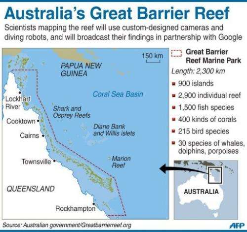
The reef is the biggest in the world, comprising more than 3,000 individual reef systems and hundreds of tropical islands. It is home to 1,500 fish species and 30 types of whale, dolphin and porpoise.
Hoegh-Guldberg said the project was an exciting combination of "real science" and popular culture, adding that he hoped it would increase public awareness of the oceans and their vulnerability to climate change.
"Oceans are undergoing major change, be that our polar seas, our kelp forests, our coral reefs and so on," he said.
The Great Barrier Reef was just the first part in what was intended to be a global project, mapping coral reefs in the world's massive oceans.
"After all it's 71 percent of the Earth's surface, it's the major habitat on the planet, we really are terrestrial organisms on a watery planet," said Hoegh-Guldberg.
Bringing people from all over the globe a first-hand experience of the reef via Google and YouTube would hopefully jog their conscience about the issue, Hoegh-Guldberg added.
"It's really important that we develop a methodology where we can bring the Earth's citizens down into the oceans so that they really do understand what's at stake and understand both the challenges and the solutions," he said.
(c) 2012 AFP


