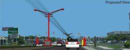
Proposed National Signage Code: What It Would Look Like in a Real Community

The 2009 National Signage Research and Education Conference, to be hosted by UC, will include presentation of a model signage code for the United States. In order to see what a community might look like if the code is adopted, UC planning students actually applied it to a Cincinnati community.
One size fits none.
That’s the conclusion of University of Cincinnati planning students who have been working throughout the summer to study business signage along one of the area’s busiest business districts: Beechmont Avenue in Anderson Township, one of the city’s eastern suburbs.
The eight students have counted signs, measured their height, measured their setbacks, determined angles of view (or blockage), visibility, legibility, determined optimal vehicular speeds for signage comprehension and more - all while working with the guidance of long-time planning practitioner, Menelaos Triantafillou, associate professor of planning in UC’s top-ranked College of Design, Architecture, Art, and Planning (DAAP). As a professional planner, Triantafillou has years of experience developing zoning and signing regulations on behalf of municipalities as well as reviewing signage applications from small businesses.
.jpg)
For this groundbreaking project, the UC students catalogued business signage in the Beechmont Avenue corridor from the intersection of Salem Road and Beechmont in Anderson Township westward to the Clermont County line (approximately three miles). Then, they determined how the area would need to adapt if a national signage code - being presented at the Oct. 13-15 National Signage Research and Education Conference - were widely adopted.
The students' work will be presented at the 2009 National Signage Research and Education Conference (NSREC), sponsored by the National Signage Foundation, Inc., but held at UC Oct. 13-15, 2009.
“The idea,” according to Triantafillou, “Is to improve the visual quality of business districts balanced with the needs of consumers to identify commercial establishments, needs of business owners and communities’ needs to manage the character of the environment.”
Paul Drury, assistant director of development services in Anderson Township, agreed.
He explained, “Signage is always a contentious issue here or anywhere else. There are business’ wants and needs, residents’ wants and needs, aesthetic concerns, and all the different interests compete. For us in Anderson Township, this is exacerbated by the fact that we had minimal signage regulations until the early 1990s.”
Student Hans Williams, 24, from Havre, Montana, stated that the corridor has a large number of signs, resulting in density of placement and perception: “The corridor is indicative of most American business districts. Because of the explosive growth in the past, signs block one another. They don’t serve their marketing and aesthetic purposes for businesses or the community.”
.jpg)
UC’s Triantafillou added that the plaza signs with multiple business listings make it difficult for drivers to quickly find the location they want: “Most of the signs along Beechmont are legible only with difficulty, especially if an auto is going at 40 miles per hour.”
In finding solutions to such challenges to be found in the proposed national sign code, the students made the following suggestions to Anderson Township in regard to Beechmont Avenue and its signage:
Flexibility: The students divided the corridor into five difference zones based on the character and existing congestion in those zones. “So,” said Triantafillou, “We don’t have precisely the same rules for everyone along the entire stretch of the corridor. Within this flexibility, the goal remains the same: reduce clutter, aid businesses and the character of the community.”
The five zones are
• Small-scale suburban businesses near the intersection of Salem and Beechmont Avenue. These represent the oldest businesses in the community, with the smallest lots and older building stock.
• Mixed-use development located at the Anderson Towne Center, a pedestrian mall.
• Office district.
• Suburban commercial district.
• Suburban big box/large-scale commercial district.
Color consistency: Each zone is marked by its own identifying color. So, signage and lighting poles in each zone shares the same colors, as a visual marker for drivers to navigate and find businesses.
Signs and utility poles to the center: The students recommend moving the existing signage found on both sides of the busy thoroughfare and integrating these into larger, electronic sign options in a green median strip in the middle of the roadway.
.jpg)
In explaining this last option, Triantafillou explained the research behind it. “A driver has a limited cone of vision to detect a sign at a certain height and distance. Many signs are difficult to see when driving. A median strip, 12 feet wide, would become the home for large, attractive electronic signage that would reduce clutter while - along with the color coding of poles for each zone - would aid business while at the same time adding to the character of the area.”
Anderson Township’s Paul Drury said that the idea for a central median for signage and utility poles was something to consider. “We are interested in access management and reducing overall clutter along the corridor. We will look at the idea in the light of timing, cost constraints and other issues.”
Provided by University of Cincinnati (news : web)


