Birth of a hurricane: Researchers will fly into tropical weather disturbances
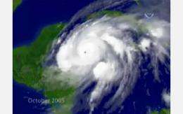
(PhysOrg.com) -- Summer storms are a regular feature in the North Atlantic, and while most pose little threat to our shores, a choice few become devastating hurricanes.
To decipher which storms could bring danger, and which will not, atmospheric scientists are heading to the tropics to observe these systems as they form and dissipate--or develop into hurricanes.
By learning to identify which weather systems are the most critical to track, the efforts may ultimately allow for earlier hurricane prediction, and add several days to prepare for a hurricane's arrival.
With primary support from NSF, the Pre-Depression Investigation of Cloud Systems in the Tropics (PREDICT) mission will run from August 15 to September 30, 2010, the height of hurricane season.
Flying aboard the NSF/NCAR Gulfstream V (G-V) research aircraft, formerly known as HIAPER, researchers will make observations from close proximity, and above, storm systems. In addition to deploying dropsondes--parachute-borne instrument packages--the researchers will use remote sensing and cloud physics instruments to gather data on temperature, humidity, wind speed and direction, and characteristics of ice particles and their nuclei, which may include African dust.
"We hope to test recently developed hypotheses about flow features of tropical waves that help distinguish which ones will develop into tropical storms," said Christopher Davis, of the NSF-sponsored National Center for Atmospheric Research (NCAR) and a principal investigator on the project. "These hypotheses require measurements across hundreds of miles, but with details in places down to one mile or so, and even less when we consider the ice particles themselves."
The NSF/NCAR research team will coordinate their observations with two concurrent, but independent, missions in the region: the National Aeronautics and Space Administration (NASA) project known as GRIP (Genesis and Rapid Intensification Processes) and the National Oceanic and Atmospheric Administration (NOAA) IFEX (Intensity Forecasting Experiment).
"The NSF/NCAR G-V offers us unprecedented capability to collect critical atmospheric measurements over regions far larger than has been practical for traditional ‘lower-and-slower' turboprop hurricane-hunter aircraft," added Bradley Smull, NSF program director for Physical and Dynamic Meteorology. "The G-V will allow our investigators to sample the inner workings of a large number of towering tropical cloud systems, and ultimately to better discriminate those that will develop into full-blown hurricanes from those that will not."
In addition to researchers from NCAR, the project will include collaborators from the Naval Postgraduate School, University at Albany-SUNY, University of Illinois at Urbana-Champaign, University of Miami, NorthWest Research Associates of Redmond, Wash., New Mexico Tech, Purdue University, and University of Wisconsin-Madison.
Read more, including specific details about the flight, in the NCAR press release "Hurricane study to tackle long-standing mystery".
Provided by National Science Foundation


