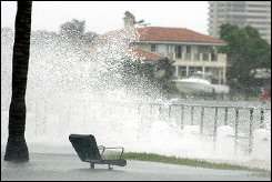
New Orleans faces 3-in-10 chance of hurricane winds
Still reeling from the devastation of Hurricane Katrina, the Louisiana Gulf Coast faces the highest probability of any area in the country of getting struck by hurricane-force winds during the 2006 hurricane season, a University of Central Florida professor and his Georgia colleague said Wednesday.
The New Orleans area has a nearly 30 percent chance of experiencing hurricane-force winds during a season that is likely to further disrupt oil production levels in the Gulf of Mexico, potentially causing another increase in already high oil and gasoline prices, said UCF statistics professor Mark Johnson and Chuck Watson, founder of the Kinetic Analysis Corp. of Savannah, Ga.
Johnson and Watson's analysis of the probability of hurricane-force winds covered the entire Atlantic Ocean and Gulf of Mexico coastlines. Details for 28 cities in the analysis are provided below.
Of those 28 cities, New Orleans faces the highest probability of experiencing hurricane-force winds in 2006 at 29.30 percent. The highest probabilities of hurricane-force winds in the 16 Florida cities that are included were 20.61 percent for Key West, 20.29 for Pensacola and 18.94 for West Palm Beach.
"While the risks in New Orleans, North Florida and Southeast Florida may be higher than in other areas, everyone should prepare thoroughly for the upcoming hurricane season," Watson said. "You want to be ready for the worst-case scenario even if there's only a 5 percent chance that it will happen."
Johnson and Watson operate the public Web site, hurricane.methaz.org, that tracks storms worldwide with hourly updates and projects damage for individual counties based on expected winds, waves and storm surges. The Web site also includes a computer model with every oil platform, pipeline, refinery and terminal in the Gulf of Mexico.
The probabilities of hurricane-force winds are based on statistical models that incorporate the paths of storms from the past 155 years and expected global climate conditions this year. The researchers also used their computer model to simulate how every storm since 1851 would have affected oil and gas infrastructure in May 2005.
Production levels of oil and gas in the Gulf remain about 20 percent below normal because of the severe damage to platforms, pipelines and refineries last year.
The combination of La Nina weather conditions that are expected to continue throughout the summer and warmer-than-normal Gulf water temperatures increases the chances of hurricanes disrupting oil production again, said Johnson and Watson.
Major disruptions to Gulf oil production this year could lead to sharp increases in already high oil and gasoline prices because about one-fourth of U.S. oil production is based in the Gulf. Problems would be compounded by the fact that few companies are equipped to conduct major repairs to platforms and refineries, and those companies already have a large backlog of repairs because of prior storms.
"Because the oil market is already tight, Americans should brace for a substantial, long-term increase in the price of gas if a major hurricane strikes the Gulf of Mexico this year," Johnson said.
Disruptions as severe as last year's caused by hurricanes Katrina and Rita can be expected once every 20 years, they concluded. Those storms led to the loss of 153 million barrels of oil production.
The average annual disruption shown by the computer model in years with conditions similar to 2006 is 98 million barrels, or 18 percent of the annual Gulf production, while the median disruption was 65 million barrels, or about 12 percent of annual Gulf production.
Johnson is an expert in the statistical aspects of hurricane modeling and forecasting. Watson and the Kinetic Analysis Corp. specialize in developing hazard models based on engineering and geophysics. They have worked together on hurricane-related research projects for 10 years, and they began studying oil and gas production impacts in 2004.
The Web site, http://hurricane.methaz.org, tracks storms worldwide with hourly updates and also includes projections for property damage throughout storms' anticipated paths.
Source: University of Central Florida


