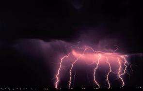
Scientist finds intense lightning activity around a hurricane's eye

When you think of lightning, you think of a thunderstorm. Many people also assume that hurricanes have a lot of lightning because they are made up of hundreds of thunderstorms.
However, according to Dr. Richard Blakeslee of the NASA Marshall Space Flight Center (MSFC) in Huntsville, Ala., "Generally there's not a lot of lightning in the hurricane eye-wall region. So when people detect a lot of lightning in a hurricane, they perk up -- they say, okay, something's happening."
In 2005, scientists did perk up, because a very strong Hurricane Emily had some of the most lightning activity ever seen in a hurricane. Scientists are now trying to determine if the frequency of lightning is connected to the hurricane's strength.
In July of that year, NASA lightning researchers joined hurricane specialists from the National Oceanic and Atmospheric Administration (NOAA) and 10 universities for a month-long Tropical Cloud Systems and Processes (TCSP) field experiment in Costa Rica. The purpose of the mission was to determine what weather, climate and other factors that helped create tropical storms and hurricanes. They also wanted to learn about what makes these storms strengthen. All of these organizations study lightning in hurricanes to get a better understanding of the strengthening or weakening (intensification) of the storms.
Hurricane Emily was one of three named storms (the others were Hurricane Dennis and Tropical Storm Gert) observed during the TCSP field experiment. Scientists flew NASA's ER-2 high-altitude weather plane above Emily, where they recorded some of the most powerful lightning activity ever seen in a hurricane's eye-wall. Emily was one of the largest, most violent hurricanes ever to be documented by the ER-2 plane.
During the flights, scientists detected both cloud-to-ground lightning strokes and cloud-to-cloud lightning in the thunderstorms surrounding Emily's eye. They also found that the "electric fields," or areas of the atmosphere that contained electricity above Hurricane Emily, were some the strongest ever recorded. "We observed steady fields in excess of 8 kilovolts (8,000 volts) per meter (3.2 feet)," says Blakeslee. "That is huge--and comparable to the strongest fields we would expect to find over a large land-based thunderstorm."
The field experiment concluded before the birth of hurricanes Katrina and Rita in 2005. However, scientists also observed significant lightning in the eye walls of hurricanes Katrina and Rita through long range ground-based lightning detection networks. That similarity has generated more interest in trying to understand the connection between lightning activity and hurricane development, intensification and behavior.
Source: NASA/Goddard Space Flight Center


