Related topics: nasa , launch , space


Satellite

hide

In the context of spaceflight, a satellite is an object which has been placed into orbit by human endeavor. Such objects are sometimes called artificial satellites to distinguish them from natural satellites such as the Moon.

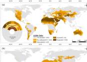
The first artificial satellite, Sputnik 1, was launched by the Soviet Union in 1957. By 2009 thousands of satellites have been launched into orbit around the Earth. These originate from more than 50 countries and have used the satellite launching capabilities of ten nations. A few hundred satellites are currently operational, whereas thousands of unused satellites and satellite fragments orbit the Earth as space debris. A few space probes have been placed into orbit around other bodies and become artificial satellites to the Moon, Venus, Mars, Jupiter and Saturn.

Satellites are used for a large number of purposes. Common types include military (spy) and civilian Earth observation satellites, communication satellites, navigation satellites, weather satellites, and research satellites. Space stations and human spacecraft in orbit are also satellites. Satellite orbits vary greatly, depending on the purpose of the satellite, and are classified in a number of ways. Well-known (overlapping) classes include low Earth orbit, polar orbit, and geostationary orbit.

Satellites are usually semi-independent computer controlled systems. Satellite subsystems attend many tasks, such as power generation, thermal control, telemetry, attitude control and orbit control.

For more information about Satellite, read the full article at Wikipedia.
This text uses material from Wikipedia and is available under the GNU Free Documentation License.


News tagged with satellite

results timeline


New Method to Measure Snow, Soil Moisture With GPS May Benefit Meteorologists, Farmers

Space & Earth / Earth Sciences

created 17 hours ago | popularity not rated yet | comments 1

(PhysOrg.com) -- A research team led by the University of Colorado at Boulder has found a clever way to use traditional GPS satellite signals to measure snow depth as well as soil and vegetation moisture, a technique expected ...


SMOS satellite instrument comes alive

SMOS satellite instrument comes alive (w/ Video)

Space & Earth / Space Exploration

created Nov 19, 2009 | popularity not rated yet | comments 0

The MIRAS instrument on ESA's SMOS satellite, launched earlier this month, has been switched on and is operating normally. MIRAS will map soil moisture and ocean salinity to improve our understanding of the ...


DirecTV to appoint PepsiCo executive as CEO (AP)

DirecTV to appoint PepsiCo executive as CEO

Technology / Business

created Nov 18, 2009 | popularity not rated yet | comments 0

(AP) -- DirecTV Group Inc. is naming the vice chairman of PepsiCo Inc. as its chief executive.


QuikScat and Aqua providing important data on Tropical Storm Anja

QuikScat and Aqua providing important data on Tropical Storm Anja

Space & Earth / Earth Sciences

created Nov 18, 2009 | popularity not rated yet | comments 0

Anja has continued to weaken over the last 24 hours, and NASA's QuikScat satellite has confirmed that the once mighty Category 4 Cyclone is now a tropical storm in the southern Indian Ocean. Two instruments ...


Sezmi offers a new kind of TV service

Technology / Telecom

created Nov 17, 2009 | popularity 4 / 5 (2) | comments 0

Sezmi, a Silicon Valley startup that's pioneering a new type of TV service, is opening up a public test of its system Monday in California.


Terra satellite spots Tropical Cyclone Anja, the first of the southern season

Terra satellite spots Tropical Cyclone Anja, the first of the southern season

Space & Earth / Earth Sciences

created Nov 16, 2009 | popularity 3 / 5 (1) | comments 0

NASA's Terra satellite captured a stunning image of Anja, the first tropical cyclone of the southern Hemisphere cyclone season. When Anja formed on Saturday, November 14, in the Southern Indian Ocean, about ...


TRMM satellite mapped 'Ida the Low's' rainfall from space

TRMM satellite mapped 'Ida the Low's' rainfall from space (w/ Video)

Space & Earth / Earth Sciences

created Nov 16, 2009 | popularity not rated yet | comments 0

The Tropical Rainfall Measuring Mission satellite known as "TRMM" has the ability to measure rainfall from space, and assessed the heavy rainfall from last week's coastal low pressure area, formerly known ...


Penguins and sea lions help produce new atlas

Penguins and sea lions help produce new atlas

Biology / Ecology

created Nov 16, 2009 | popularity not rated yet | comments 0

Recording hundreds of thousands of individual uplinks from satellite transmitters fitted on penguins, albatrosses, sea lions, and other marine animals, the Wildlife Conservation Society (WCS) and BirdLife ...


Investigating muscle repair, scientists follow their noses

Investigating muscle repair, scientists follow their noses

Biology / Cell & Microbiology

created Nov 16, 2009 | popularity 4 / 5 (4) | comments 0

When muscle cells need repair, they use odor-detecting tools found in the nose to start the process, researchers have discovered.


NASA on track for Monday space shuttle launch (AP)

NASA on track for Monday space shuttle launch

Space & Earth / Space Exploration

created Nov 14, 2009 | popularity 4 / 5 (2) | comments 0

(AP) -- NASA has cleared space shuttle Atlantis for liftoff Monday on a trip to stock up the International Space Station with several years' worth of spare parts.


Satellite imagery confirms Ida's low is finally moving away from the east coast

Satellite imagery confirms Ida's low is finally moving away from the east coast

Space & Earth / Earth Sciences

created Nov 13, 2009 | popularity not rated yet | comments 0

Satellite imagery and weather ground station readings today along the Mid-Atlantic indicate "Ida the coastal low pressure area" is finally moving away from the U.S. east coast.


Former Ida a huge rainmaker, causing flooding in the Mid-Atlantic

Former Ida a huge rainmaker, causing flooding in the Mid-Atlantic

Space & Earth / Earth Sciences

created Nov 13, 2009 | popularity 5 / 5 (1) | comments 0

The coastal low, formerly known as Ida, is currently quasi-stationary off the North Carolina coast, adding more rain on top of what it has already brought. The low is creating serious flooding from northeast ...


El Nino Picking Up Steam

El Nino Picking Up Steam

Space & Earth / Earth Sciences

created Nov 13, 2009 | popularity 4.6 / 5 (5) | comments 1

(PhysOrg.com) -- The latest image from the U.S./French Jason-2 satellite finds a strong wave of warm water heading toward the Americas, fueling El Nino.


Brazil: Deforestation sees biggest drop in 20 yrs (AP)

Brazil: Deforestation sees biggest drop in 20 yrs

Space & Earth / Environment

created Nov 12, 2009 | popularity 5 / 5 (7) | comments 1

(AP) -- Deforestation in the Brazilian Amazon dropped nearly 46 percent from August 2008 to July 2009 - the biggest annual decline in two decades, the government said Thursday.


Greenland ice cap melting faster than ever

Greenland ice cap melting faster than ever

Space & Earth / Earth Sciences

created Nov 12, 2009 | popularity 3.6 / 5 (32) | comments 24

Satellite observations and a state-of-the art regional atmospheric model have independently confirmed that the Greenland ice sheet is loosing mass at an accelerating rate, reports a new study in Science.